


Maps can be any size
This experiment sprang from my desire to become more competent with graphic design software.
I've been using Affinity Designer for a little over a year now. It's a very solid Illustrator replacement, and much more affordable than Adobe's subscription model.
I had just finished designing a pixel-perfect garden center icon for the Maki icon library. Communicating an idea with only 15 pixels square was a fun challenge.


I wanted to take this challenging limitation and apply it to maps.
The Challenge
Vectors are awesome, but sometimes your crisp, beautiful lines have to be turned into pixels. This is usually not a problem because of the high density pixels-per-inch of our modern displays, but what if you only gave yourself 64 pixels to play with?

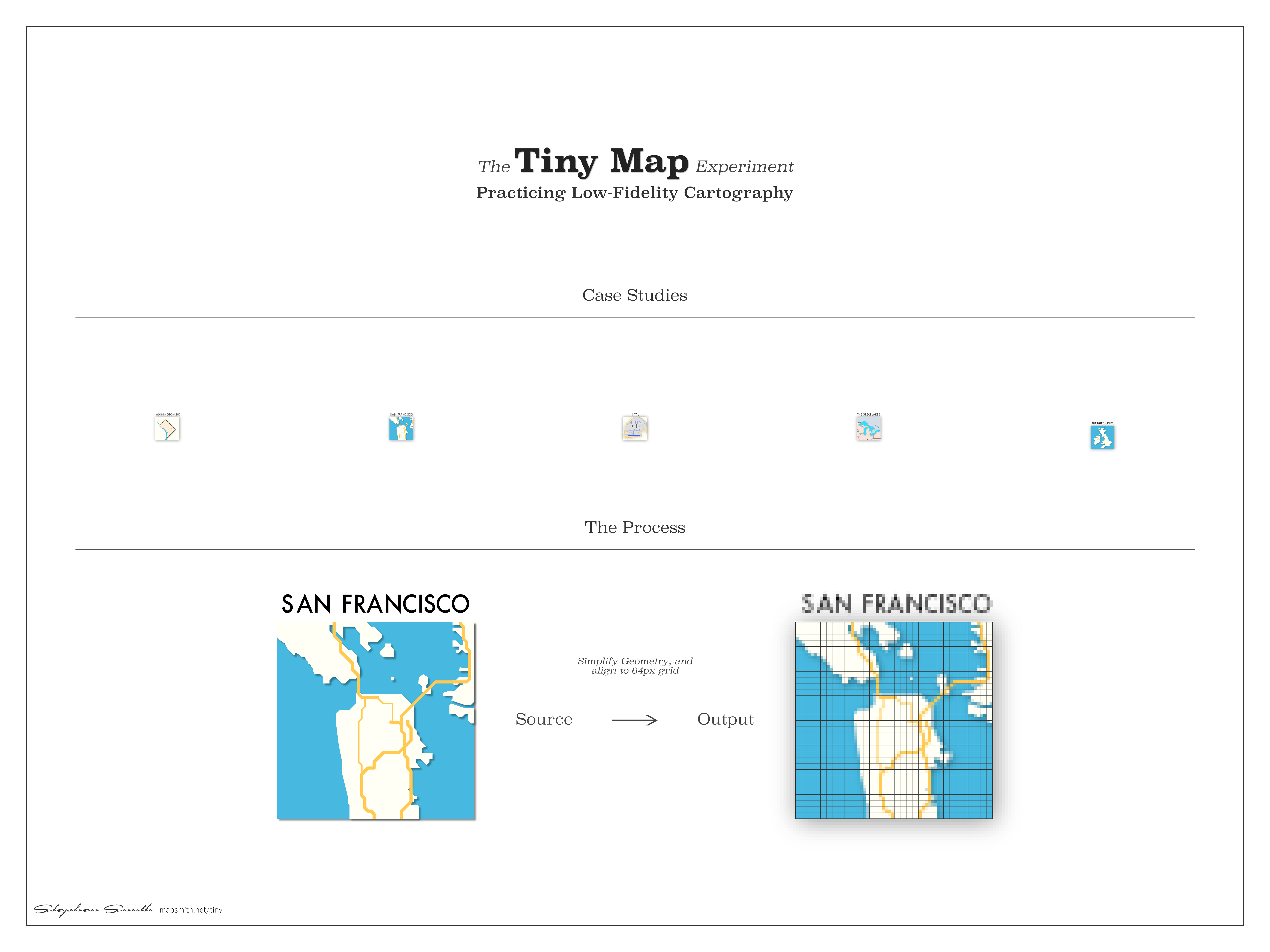
Essential Geography
I downloaded relevant data from OpenStreetMap and NaturalEarth and loaded them into ArcMap. After using the Simplify Geometry geoprocessing tool, I exported the data as SVG and loaded it into Affinity.
Then, using the lessons Nathaniel taught me in my pull request, I set about aligning and refining the geographic representations for perfect pixel presentation. This involved quite a bit of subtraction and simplification.
Brit-ish Isles
The Poster
In keeping with the minimal style of the maps, I decided to make use of tons of negative space to make the maps feel even smaller.
Click on the image below to download a higher resolution copy.
Where to next?
Want me to draw your favorite geography? Get in touch!
Just want to talk about maps? Get in touch anyways! I love helping people.